CanKata

CanKata

Sunday, November 25, 2012

No Chagos for us – for now

I think we’ll have to wait until 2018 or later to visit a place that has been on the top of our list since we started planning our sailing adventure: the Chagos archipelago.

I saw the warning posted by a Facebook friend: “Piracy Still a Clear and Present Danger in Gulf of Aden and Indian Oceanhttp://www.noonsite.com/General/Piracy/piracy-still-a-clear-and-present-danger-in-gulf-of-aden-and-indian-ocean

We followed up with our friend, and he gave us a couple more web sites to check out. They are listed below.

We were given lots to think about by an email this same friend sent us. Here are some excerpts:

“I would rely on military sources in my planning of my route when sailing from Thailand to South Africa. After all the Indian Ocean is considered a war zone and the military cannot be expected to provide any assistance to pleasure vessels whatsoever.  The military mission is to protect commercial shipping period.  Insurance companies assess risk for their insurance of commercial vessels and have shaded the entire Indian Ocean as a listed area as you know. …
 
My known information on insurance assessment is that when Quest was pirated they were insured and were within the acceptable route limits of their insurance company (a Lloyds company affiliated with the Blue Water Rally). Once Quest was returned to the United States by the military the insurance company absolved themselves completely of any claims made against Quest because they claim that the vessel was pirated and therefore not insured immediately before, during or after the pirate attack.  There was and will be no payment for the damage to Quest or the murder of the crew onboard by the insurance company.
 
… [If] you transit a known pirate area (i.e. Maldives and Chagos) your insurance will not be valid if you are attacked by pirates.
 
… [If] I … wanted to safely get across the Indian Ocean I would take the World Arc route across the Indian Ocean
(
http://www.worldcruising.com/WORLDARC2014/itinerary.aspx).  I would bypass the Maldives … and bypass Chagos (a known pirate area today) and head to Mauritius, Reunion and onto Richards Bay during the upcoming sailing season.  I would take the advice of UKMTO, EU NAVFOR, US Naval Forces, Spanish Navy and French Navy and get out of the Indian Ocean area as quickly, as directly and as safely as possible. …

While the number of attacks in the Indian Ocean has decreased significantly
this past crossing season the reasons are fairly clear:  1) There are more
naval vessels using deadly force against the pirates, 2) Most merchant
vessels now employ armed guards onboard and these x-military people shoot to kill, 3) The 2011 sailing season saw historically high levels of piracy so
even cutting those attack numbers in half results in higher than average
pirate attacks even this past 2012 season.


[END OF EXCERPTS FROM EMAIL]

So after giving it more thought and weighing the risks, we have decided to alter our route. At this point in time, our plan is to head down the west coast of Sumatra, Indonesia, touch down at the island of Cocos Keeling, then cross over to Mauritius (with maybe a stop at Rodriguez). We have to get cracking on our plan and try to find others going this same way.

We were sooooo looking forward to a month in the Chagos – away from civilization, in the midst of nature about as untouched as it can get, and in fishing grounds that would keep us well fed for at least a month. But like I said – maybe we’ll go in 2018 or 2019 … we haven’t scratched it off our list yet.

Need a Maldives courtesy flag?

When we were still on our Thailand-Maldives-Chagos-Mauritius plan, we stopped at the flag store and bought a few courtesy flags. They were all out of the Chagos, but we bought, among a few others, the flag for the Maldives.

When we got back to CanKata, I integrated the new flags in alphabetical order with all the others we have, and I discovered that we already had a Maldives flag. So now we have two. And we don’t need either one now that we are on the Thailand-Sumatra-Cocos Keeling-Mauritius plan.

I think I need to segregate some of our flags into a “Places we probably won’t ever sail to” flag bin.  We had once thought that we would sail through the Red Sea and Mediterranean (hard to believe it is no longer possible), and bought flags in preparation.  Once upon a time, we thought we would need flags for:
Croatia
Egypt
Eritrea
Greece
Iran
Israel
Italy
Maldives (2!)
Malta
Morocco
Oman
Sri Lanka
Sudan
Turkey
Yemen

Our bin with “flags we will need” is much smaller now. But our adventures will be just as big. And now we can add an African safari or two to our list. A pretty good trade-off, I think.

Saturday, November 24, 2012

A Quick Trip to Malaysia

Thailand law requires that we take our boat out of their country every six months – or, sometimes, once a year if the boat is in a marina (which CanKata was). So our time was up in November.

We left Phuket for Langkawi, Malaysia on November 5. We stopped at Phi Phi Le, Ko Rok Nok and Tarutao on our way there. These anchorages provided some spectacular views of the skies, and we even managed to sail some of the way (not always easy on this route).
 
View from Phi Phi Le
 
High on our "favourite" list: Ko Rok Nok

View from Tarutao

The dark, early morning sky was amazing: Venus rising in the east, Pluto setting in the west, and Orion directly above us, with the brightest star Sirius close to Orion. The early night sky was pretty active: one night we counted seven satellites.

On November 8th we arrived in Kuah, Langkawi – a safe but dirtied-water harbor – and immediately got to work buying a variety of boat parts and provisions that we can’t get in Thailand, like good powdered milk and affordable feta cheese. We met up with old friends (Tigger) and made some new ones (Emelia and Vamp) and enjoyed using the services of Surin, whose office is based right near the dinghy dock. She calls herself a “mini chandlery” and works hard to help you get what you need.

There's been lots of development near the dinghy dock in Kuah. Even Karaoke!
The chandlery didn't have much of what we needed.
The view from Kuah: a storm developing in the west at sunset.


We gave away the last of our books when in Kuah. Our shelves now have mostly reference books and cruising guides and duplicate flags of the Maldives. We both now have Kindle book readers and love them. They don’t smell musty, they don’t have little spider mites, and hundreds of books weigh next to nothing. The batteries last for days and days. Yes, we highly recommend them to our fellow sailors.

On November 20th, with all the stuff we needed safely stowed away and all our books with new homes, we started our journey back to Thailand. “See you in 2018” was our farewell message to Tigger and Emelia. We will probably meet up with Vamp again in Thailand.

The winds suggested that we take a different route home. That’s the beauty of the trip between Phuket and Langkawi – lots of islands to pick from, lots of variety for route planning. We stopped at Tarutao North, Ko Talibong, Ko Lanta Yai (where we relaxed an extra day), and at Monkey Beach, Phi Phi Don (where we played with a wee dolphin). Between Talibong and Lanta, we hardly motored at all. And the amazing thing about both going and coming: it didn’t rain enough to be a bother, but it rained enough to clean our canvas and allow us to catch some water for our tank. It tastes so much better than our reverse-osmosis water!
 
View from Talibong, after this system rained on us.
View from Talibong after the sun set a little lower.
 
View from Ko Lanta Yai

Another view from Ko Lanta Yai, a little later. See the green?
 
Another view from Ko Lanta the next night: a stark difference.
 
Darrel and the dolphin at Phi Phi Don
 
Loretta petting the dolphin at Phi Phi Don.
 
The morning sky over Phi Phi Don
CanKata heading home to Phuket
Sailing in clean water allows me another treat: doing laundry in salt water. It always gives me a thrill to practice water conservation. My super-duper $80 washer/spinner squeezes all the salt water out, and then all I need is one rinse in fresh, another good spin, a few hours hanging in the breeze and sun, and Voila – spring-smelling laundry with just a small tub of fresh water.

One small frustration we had on our journey was our inability to use our ham radio for emails – something that will be critical for us when we leave Thailand in February. We can’t figure out if the problem is related to software, hardware, or uncooperative air waves. We are still working on a resolution and MUST get this solved before we leave.

We had a visitor on board for most of our journey: a little gecko. We hardly saw it, but often saw a little piece of black and white poo which is the calling card of the gecko. We haven’t seen any evidence for a few days now, and wonder if it went ashore at Monkey Beach.  Too bad – we didn’t have one mosquito aboard while it was here.

So good-bye gecko, good-bye books, and good-bye Malaysia. “See you in 2018”, Langkawi, or maybe earlier if we need to change our route once again. One never knows for sure.

P.S. I am seeing regular updates on Facebook about our many Aussie sailing friends who are arriving home safely from S.E. Asia. Well done, mates!

Saturday, September 22, 2012

Planning for the Future


September 2012

By Darrel


The author ... doing some planning?
Yikes, I get the shivers just thinking of this title for two reasons. The first reason is because planning was a big part of my job as a housing researcher, and probably the least most exciting time of the year, yet one of my job tasks which management placed a lot of emphasis on. The second reason is because in my current situation, i.e., cruiser (although I have to use that term loosely given that I am typing this entry from our condo (which has not drifted or dragged since we have been here) planning is a very abstract concept and is most often written in the sand on a tidal beach.


 Actually I am writing this entry at the request of my co-captain, Loretta.  She says that she gets a number of enquiries by email and Facebook (of which I have no friends) whom are interested in where and when CanKata is planning on heading once we have restarted our circumnavigation.

Well I don’t mind telling people about our possible, projected plans and best guess as to where and how our future will likely or probably unfold, but to put it down in writing which could be used as a record and held against me – YIKES!

The following is based on a true PLAN but the names and locations have been withheld to protect DARREL.

Before I provide you with an outline of our intended course and schedule I feel I need to inform you as to the tools that have gone into the planning process. Hopefully at this point you will think, okay I just finished reading the blah blah blah that Darrel wrote regarding a new way to get their boat out of the water, and have now decided to click that little red box with an X in it at the top right corner of the screen.

For those of you who are still reading, here is a quick listing of the tools that we have used to help us plan the route of our anticipated circumnavigation.

Studying our Jimmy Cornell books.
 
World Cruising Routes by Jimmy Cornell which provides route planning advice and essential information on over 500 sailing routes around the world. It tells us the best time to travel along various routes and gives essential information about the wind and currents that can be expected during that time.

World Cruising Handbook by Jimmy Cornell which can be described as a “nautical tourist guide” and provides need-to-know information about the most popular cruising destinations around the world. It tells us how long we can stay in the various places we intend to visit.

Visual Passage Planner is software designed to assist in the planning of offshore voyages. It lets you plot your intended course and it will depict weather conditions, i.e. wave height, wind speed and direction, probability of hitting a gale, etc., for the time that you plan to be undertaking that leg of the voyage.

Cruisers network which consists of web sites, blogs, emails, and anything else in cyberspace with the exception of Facebook (did I mention I don’t have any friends). Notes from cruisers who have taken the same path as we hope to follow in their wake are invaluable and abundant. This is especially true when you venture off the main path, as we expect to do for certain legs of our circumnavigation.

Insurance Policies also dictate where and when we can make a passage. Any area where piracy is active is off limits, thus we will not be taking the usual Red Sea route, and as it stands today we will not even be able to go through the Maldives. Even the Chagos islands are being questioned as to whether or not they are safe. Also, insurance policies stipulate that you cannot be sailing an area where a “named storm” is a possibility.  I’ll bet insurance providers don’t have a lot of Facebook friends either.

The last tool that we use to help us determine our path is to use current weather reports and superimpose those reports onto the area where we hope to be at that same time but only one to six years later. In other words verifying the other tools mentioned above to determine if climate change has had any effect on the sea and wind in the areas we are thinking of going.
 
Plotting, on computer, the first part of the circumnavigation.
 
And here's how we plan to head back after spending time in the Caribbean.

Having said all that, and providing the tide doesn’t come in to wash away our well thought out plan, here is the schedule that we may end up taking.

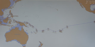
But before I do, I must emphasise that the first leg of our voyage is to cross the Indian Ocean and at this time we have plotted 4 different routes. The preferred route has us leaving Thailand in February and takes us to Sri Lanka, or close to it, and then south to the Maldives, and then down to the Chagos islands and from there off to Mauritius. But as said earlier this route now falls into the piracy zone. The second route leaves Thailand in March and takes us down the Malacca Straight to Singapore and then through Indonesia, i.e., Java and Sumatra and then from there off to Mauritius. This route isn’t our preference since we have already done the Malacca Strait once and were not impressed the first time.  Route number 3 takes us from Thailand down the West coast of Sumatra and then hoping off to either the Chagos, or straight through to Mauritius. We have to wait to see how the piracy issue is around the Chagos before making that decision. In all cases, once we get to Mauritius the next stop will be Reunion Island and from there we will head straight for Richards Bay, South Africa. We will be avoiding Madagascar, again due to the pirates.

Here is a table showing our predicted route and schedule:
 

Thailand to Thailand

From                                  To                                 Approximate Date(s)                                   Distance
                                                                                      (Leaving/Arriving)

Phuket
Maldives
L Feb 1       A Feb 15 (2014 )
1500
Maldives
Maldives
1 1/2 month
300
Maldives
Chagos
L Apr 1       A Apr 3
300
Chagos
Mauritius
L May 3      A May 15
1250
Mauritius
Reunion
L Aug 15     A Aug 16
150
Reunion
Richards Bay, South Africa
L Oct 1        A Oct 15
1400
Richards Bay
Cape Town
L Jan 1        A Jan 17 (2015)
900
Cape Town
St. Helena
L Jan 23      A Feb 6
1700
St Helena
Salvador
L Feb 9       A Feb 28
1950
Salvador
Fr Guyana
L Jun 1        A Jun 3
2000
Fr Guyana
Guyana
L Jun 5        A July 7
399
Guyana
Trinidad
L Aug 1       A Aug 10
500
Trinidad
St Martin
L Nov 1       A Jan 1 (2016)
600
St. Martin
San Blas
L May 1       A May 31
1100
San Blas
Belize
L No 1         A No 30
800
Belize
Panama
L Jan 1        A Jan 30 (2017)
800
Panama
Galapagos
L Mar 1       A Mar 9
900
Galapagos
 Marquesas
L Mar 17     A Apr  15
3000
Marquesas
Tuamotos
L Apr 25     A Apr 30
600
Tuamotos
Tahiti
L May 10    A May 12
200
Tahiti
Bora Bora
L May 15    A May 20
200
Bora Bora
Cook Islands
L May 30    A Jun 5
500
Cook Islands
Palmerston
L June 20    A Jun 22
200
Palmeston
Samoa
L Jul 1       A Jul 6
600
Samoa
 Fiji
L Jul 20     A July 26
700
 Fiji
 Vanuatu
L Aug 10   A Aug 15
600
Vanuatu
Solomon’s
L Aug 25   A Sep 2
800
Solomon’s
PNG
L Sep 22    A Oct 1
600
PNG
Philippines
L No 1       A No 15
2000
Philippines
Malaysia
L No 30     A Dec 10
600
Malaysia
Singapore
L Dec 20   A Dec 26
900
Singapore
Thailand
L Dec 27   A Jan 10, 2018
600

 
Replanning?
Please note that the information contained in this entry is NOT intended for navigation or planning purposes. Although every effort has been made to verify the accuracy of the information in this entry, the author and publisher make no warranty, expressed or implied for any errors or omissions, nor are we to be held accountable for any changes that may result.

Update Notice:  Two days after typing this entry, I made the mistake of offering Loretta one more option and that is to move our departure date up by one year. She seemed to like that idea. We are now giving a departure date of February 2013 serious consideration – stay tuned!  YIKES!!